Earthworks
In this frame, it is possible to add, edit, or remove earthworks, which can be defined as polygonal (e.g. foundation slabs, spread footings), or line (e.g. roads, railways).
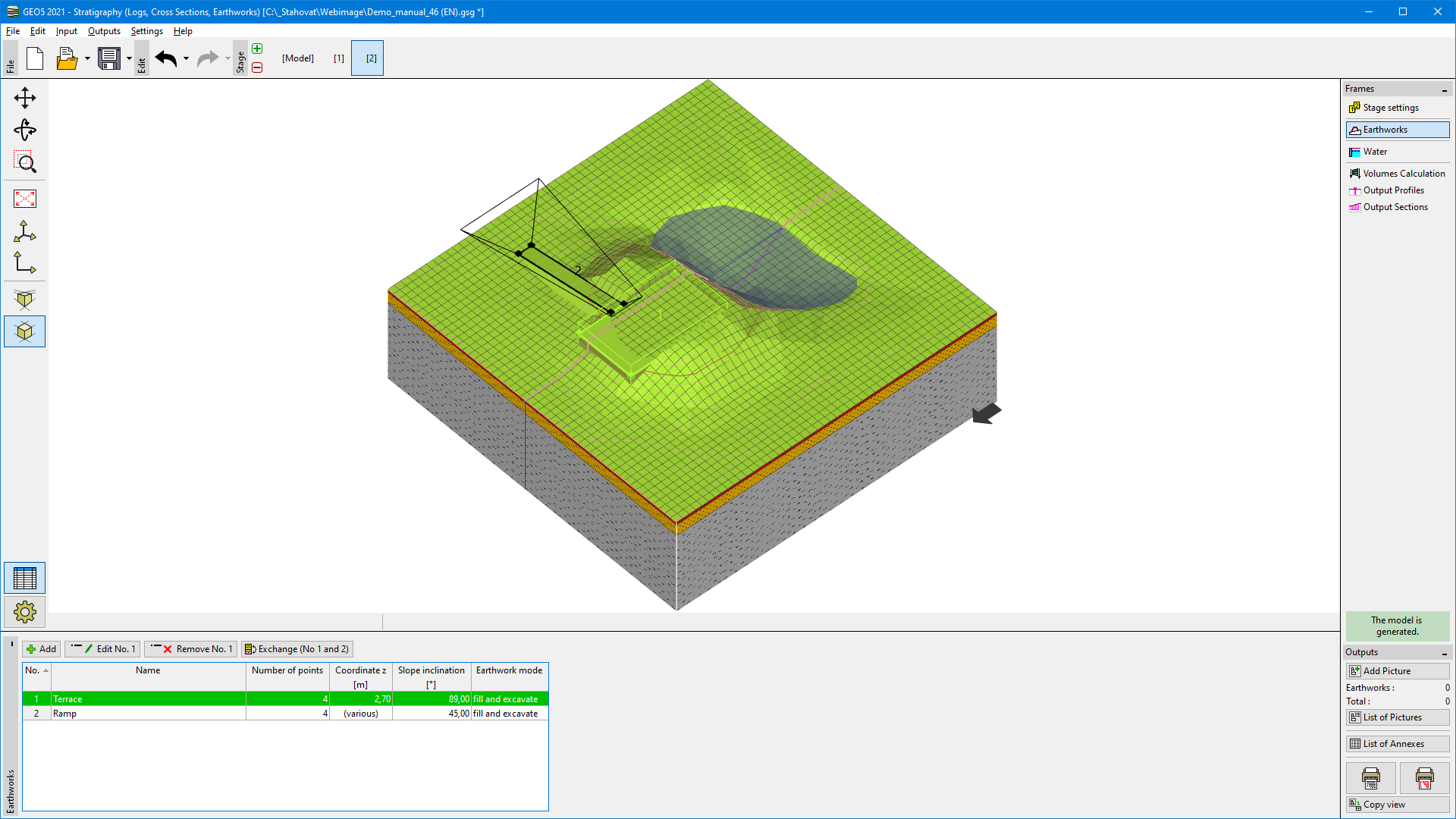 Frame "Earthworks"
The visualization of the frame is changed for the adding of earthworks after pressing the "Add" button.
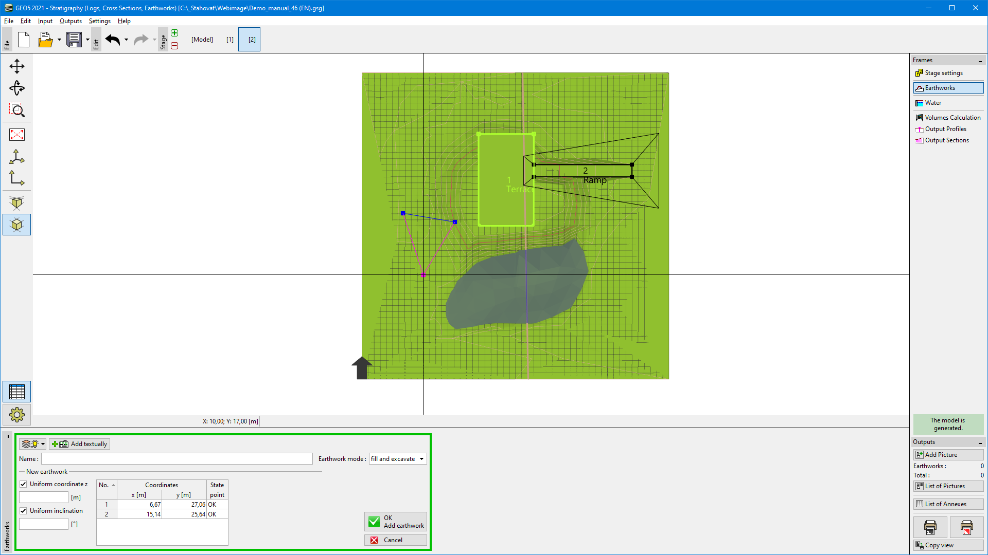 Adding of earthwork
Firstly for each earthwork, it is necessary to define its plan view - it can be done graphically using the mouse, or points can be inputted textually.
The "Earthworks mode" is an important choice, which determines how the terrain will be changed.
All points of earthwork can have a uniform height (z coordinate) and uniform slope inclination, which will be used for the connection of the new point and the original terrain. If we turn off the uniform input, z coordinate and slope inclination can be defined for each point separately - the table of points is extended for these data.
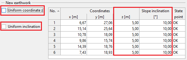 Non-uniform input of "z" coordinate and slope inclination
Note: If we want to use a vertical edge of earthwork, it is necessary to input 89° inclination (90° inclination is not allowed)
The special option is a vertical shift of the whole earthwork - it can be advantageous for transportation structures, where we want to minimalize the difference between excavated and filled soils. The calculated volumes of excavated and filled soils are shown in the "Volumes Calculation" frame.
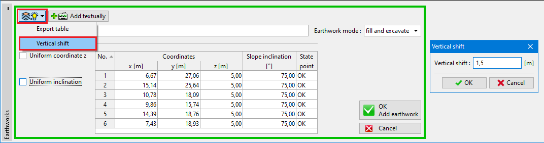 Vertical shift of earthwork